Circuit from Baldock
- Distance: 20.2 Km
- Elevation gain: 202 m
- Maximum elevation: 149 m
- Elevation loss: 202 m
- Minimum elevation: 74 m
- Moving time: 4 h 58 m
- Moving speed: 4.1 Km/h
- Maximum speed: 6.1 Km/h
- Total time: 5 h 55 m
- Global speed: 3.4 Km/h
- Date: 15/01/23
Interactive map
GPS track profile
About this GPS track
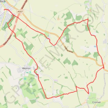
Name: Circuit from Baldock GPS track, route, trail
Coordinates: 51.94200 -0.18529 51.98498 -0.10723
Other GPS tracks
Click on a GPS track to view route, its statistics and profile.
From Royston to Letchworth
United Kingdom > England > Hertfordshire > North Hertfordshire > Royston
Distance: 23.6 Km • Elevation gain: 260 m • Maximum elevation: 168 m