Garratt Road Bridge - Swan River Circuit
Interactive map
GPS track profile
About this GPS track
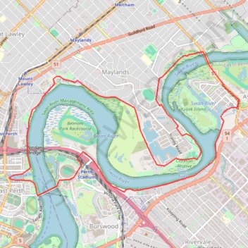
Name: Garratt Road Bridge - Swan River Circuit GPS track, route, trail
Coordinates: -31.95524 115.87772 -31.93131 115.92273
Topography: City of Perth topographic map
Other GPS tracks
Click on a GPS track to view route, its statistics and profile.
2021 Toodyay return via Kep
Distance: 229.9 Km • Elevation gain: 1,859 m • Maximum elevation: 357 m