GPS tracks, routes, trails, hikes

GPS tracks visualization and sharing, free and without registration.

Import a GPX file

Byron Bay - Ballina

#MTB #Loop

  • Distance: 65.7 Km
  • Elevation gain: 1,054 m
  • Maximum elevation: 90 m
  • Elevation loss: 1,054 m
  • Minimum elevation: 0 m

Interactive map

GPS track profile

About this GPS track

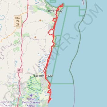
Name: Byron Bay - Ballina GPS track, route, trail.
Start: Rutherford Street, Lennox Head Urban Area, Lennox Head, Ballina Shire Council, New South Wales, 2478, Australia (-28.79791 153.59313)
End: Rutherford Street, Lennox Head Urban Area, Lennox Head, Ballina Shire Council, New South Wales, 2478, Australia (-28.79782 153.59306)
Coordinates: -28.85151 153.58928 -28.63401 153.63787

Other GPS tracks

Byron Bay Lighthouse Loop

Australia > New South Wales > Byron Bay

Cape Byron State Conservation Area. #Hike #Loop #CapeByron

Distance: 3.8 Km - Elevation gain: 166 m - Maximum elevation: 82 m - Coordinates: -28.64263 153.62654 -28.63427 153.63789

Start: Lighthouse Road, Byron Bay, Byron Shire Council, New South Wales, 2481, Australia (-28.64203 153.62654)

Cape Byron

Australia > New South Wales > Byron Bay

Cape Byron State Conservation Area. #Hike #Loop #CapeByron

Distance: 6.8 Km - Elevation gain: 190 m - Maximum elevation: 82 m - Coordinates: -28.64447 153.61329 -28.63417 153.63791

Start: 12, Bay Street, Byron Bay, Byron Shire Council, New South Wales, 2481, Australia (-28.64109 153.61329)