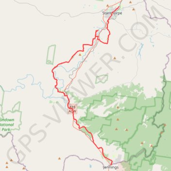
Wallangara - Stanthorpe
#Bike
- Distance: 55.8 Km
- Elevation gain: 635 m
- Maximum elevation: 880 m
- Elevation loss: 680 m
- Minimum elevation: 690 m
Interactive map
GPS track profile
About this GPS track
Name: Wallangara - Stanthorpe GPS track, route, trail
Coordinates: -28.92356 151.81306 -28.64456 151.94778
Topography: Queensland topographic map
Other GPS tracks
Click on a GPS track to view route, its statistics and profile.
Stanthorpe - Wallangara
Australia > Queensland > Stanthorpe
#Bike
Distance: 48.6 Km • Elevation gain: 676 m • Maximum elevation: 1,096 m
Wallangara - Stanthorpe
Australia > New South Wales > Jennings
#MTB
Distance: 70.9 Km • Elevation gain: 798 m • Maximum elevation: 880 m