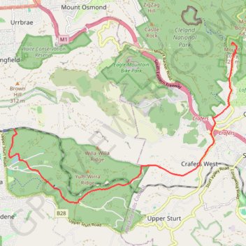
Belair National Park - Mount Lofty
#Bike
- Distance: 13.0 Km
- Elevation gain: 503 m
- Maximum elevation: 704 m
- Elevation loss: 115 m
- Minimum elevation: 270 m
Interactive map
GPS track profile
About this GPS track
Name: Belair National Park - Mount Lofty GPS track, route, trail
Coordinates: -35.01773 138.63448 -34.97392 138.71068
Topography: Adelaide topographic map
Other GPS tracks
Click on a GPS track to view route, its statistics and profile.
Valley Loop Hike
Australia > South Australia > Adelaide
Distance: 3.0 Km • Elevation gain: 58 m • Maximum elevation: 329 m