Traveston - Mount Boulder
Interactive map
GPS track profile
About this GPS track
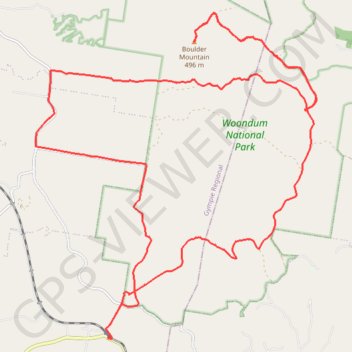
Name: Traveston - Mount Boulder GPS track, route, trail
Start: Traveston Cooran Road, Traveston, Gympie Regional, Queensland, Australia (-26.32124 152.78359)
End: Traveston Cooran Road, Traveston, Gympie Regional, Queensland, Australia (-26.32126 152.78356)
Coordinates: -26.32129 152.76485 -26.24607 152.83713
Topography: Queensland topographic map
Other GPS tracks
Click on a GPS track to view route, its statistics and profile.