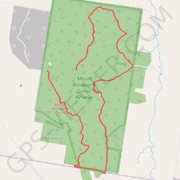
Mount Beckworth
#Hike
- Distance: 10.5 Km
- Elevation gain: 433 m
- Maximum elevation: 629 m
- Elevation loss: 358 m
- Minimum elevation: 363 m
Interactive map
GPS track profile
About this GPS track
Name: Mount Beckworth GPS track, route, trail
Start: Cork Oaks Track, Mount Beckworth, Shire of Hepburn, Victoria, Australia (-37.31127 143.70759)
Coordinates: -37.33139 143.70759 -37.29865 143.72883
Topography: Victoria topographic map