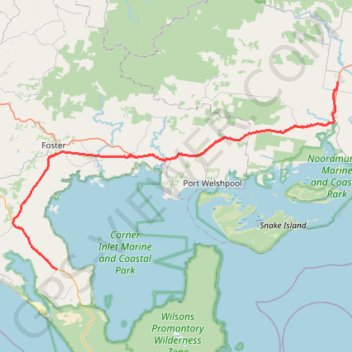
Wilsons Promontory - Yarram
#Bike
- Distance: 71.4 Km
- Elevation gain: 360 m
- Maximum elevation: 66 m
- Elevation loss: 358 m
- Minimum elevation: 3 m
Interactive map
GPS track profile
About this GPS track
Name: Wilsons Promontory - Yarram GPS track, route, trail
Start: Yanakie, Shire of South Gippsland, Victoria, Australia (-38.81215 146.20748)
Coordinates: -38.81215 146.13480 -38.56926 146.67523
Topography: Victoria topographic map
Other GPS tracks
Click on a GPS track to view route, its statistics and profile.
Yarram - Seaspray - Sale
#Bike
Distance: 99.8 Km • Elevation gain: 375 m • Maximum elevation: 98 m