Mount Mayson Loop - Hazards Beach - Wineglass Bay Lookout - Coles Bay Lookout
- Distance: 11.5 Km
- Elevation gain: 333 m
- Maximum elevation: 205 m
- Elevation loss: 333 m
- Minimum elevation: 0 m
Interactive map
GPS track profile
About this GPS track
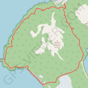
Name: Mount Mayson Loop - Hazards Beach - Wineglass Bay Lookout - Coles Bay Lookout GPS track, route, trail
Coordinates: -42.17411 148.26134 -42.14615 148.29786
Topography: Tasmania topographic map
Other GPS tracks
Click on a GPS track to view route, its statistics and profile.
Peninsula Track - Mount Freycinet
Distance: 30.4 Km • Elevation gain: 1,215 m • Maximum elevation: 599 m