GPS tracks, routes, trails, hikes

GPS tracks visualization and sharing, free and without registration.

Import a GPX file

The Pinnacle

Grampians National Park. #Hike #Loop #Grampians

  • Distance: 5.8 Km
  • Elevation gain: 347 m
  • Maximum elevation: 707 m
  • Elevation loss: 347 m
  • Minimum elevation: 400 m

Interactive map

GPS track profile

About this GPS track

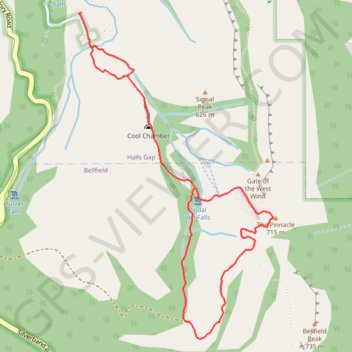
Name: The Pinnacle GPS track, route, trail.
Start: Wonderland Road, Halls Gap, Shire of Northern Grampians, Victoria, 3381, Australia (-37.14922 142.50237)
End: Wonderland Road, Halls Gap, Shire of Northern Grampians, Victoria, 3381, Australia (-37.14923 142.50243)
Coordinates: -37.16667 142.50237 -37.14917 142.51549