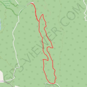
GPS tracks, routes, trails, hikes

GPS tracks visualization and sharing, free and without registration.

Import a GPX file

Tanglefoot Loop

Yarra Ranges National Park. #Hike #Loop #Yarra

  • Distance: 8.9 Km
  • Elevation gain: 410 m
  • Maximum elevation: 925 m
  • Elevation loss: 424 m
  • Minimum elevation: 626 m
  • Moving time: 1 h 58 m
  • Moving speed: 4.5 Km/h
  • Maximum speed: 19.0 Km/h
  • Total time: 2 h 3 m
  • Global speed: 4.3 Km/h
  • Date: 19/01/20

Interactive map

GPS track profile

About this GPS track

Name: Tanglefoot Loop GPS track, route, trail.
Start: Quarry Road (Tanglefoot Loop), Toolangi, Shire of Murrindindi, Victoria, Australia (-37.52776 145.52202)
End: Wirrawilla Rainforest, Wirrawilla Road, Toolangi, Shire of Murrindindi, Victoria, Australia (-37.52752 145.52124)
Coordinates: -37.55688 145.52124 -37.52750 145.53282

Other GPS tracks

Tallarook - Eildon - Hurstbridge

Australia > Victoria > Tallarook

#Bike

Distance: 278.9 Km - Elevation gain: 5,448 m - Maximum elevation: 868 m - Coordinates: -37.79054 145.04384 -37.07968 145.97137

Start: Railway Place, Tallarook, Shire of Mitchell, Victoria, Australia (-37.09301 145.10319)

End: MYT573, Eastern Freeway, Kew East, Melbourne, City of Boroondara, Victoria, 3102, Australia (-37.79019 145.04384)

Wirrawilla - Mount Saint Leonard

Australia > Victoria

Toolangi State Forest. Yarra Ranges National Park. #Hike #Loop #Toolangi #Yarra

Distance: 13.1 Km - Elevation gain: 530 m - Maximum elevation: 1,013 m - Coordinates: -37.56849 145.51919 -37.52649 145.53337

Start: Wirrawilla Rainforest Walk, Toolangi, Shire of Murrindindi, Victoria, Australia (-37.52865 145.51919)

End: Wirrawilla Road, Toolangi, Shire of Murrindindi, Victoria, Australia (-37.52855 145.51943)