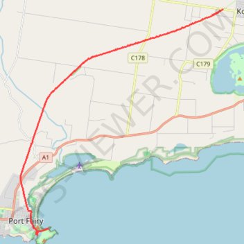
Port Fairy to Warnambool Rail Trail
#MTB
- Distance: 18.3 Km
- Elevation gain: 43 m
- Maximum elevation: 49 m
- Elevation loss: 91 m
- Minimum elevation: -1 m
Interactive map
GPS track profile
About this GPS track
Name: Port Fairy to Warnambool Rail Trail GPS track, route, trail
End: Battery Lane, Port Fairy, Shire of Moyne, Victoria, 3284, Australia (-38.38957 142.24964)
Coordinates: -38.39195 142.23381 -38.29018 142.35033
Topography: Victoria topographic map