Mount Glorious - North Kobble Creek campsite
Interactive map
GPS track profile
About this GPS track
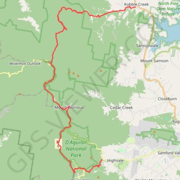
Name: Mount Glorious - North Kobble Creek campsite GPS track, route, trail
Coordinates: -27.38954 152.74687 -27.24852 152.83426
Topography: Queensland topographic map
Other GPS tracks
Click on a GPS track to view route, its statistics and profile.
D'Aguilar National Park - Mount Nebo - Cabbage Tree Creek
#MTB #Loop #Daguilar #Nebo #CabbageTree
Distance: 43.7 Km • Elevation gain: 1,569 m • Maximum elevation: 549 m