GPS tracks, routes, trails, hikes

GPS tracks visualization and sharing, free and without registration.

Import a GPX file

Glenrock State Conservation Area Loop

Glenrock State Conservation Area. #Hike #Loop #Glenrock

  • Distance: 6.5 Km
  • Elevation gain: 217 m
  • Maximum elevation: 110 m
  • Elevation loss: 218 m
  • Minimum elevation: 22 m
  • Moving time: 1 h 28 m
  • Moving speed: 4.4 Km/h
  • Maximum speed: 7.6 Km/h
  • Total time: 1 h 32 m
  • Global speed: 4.2 Km/h
  • Date: 18/01/20

Interactive map

GPS track profile

About this GPS track

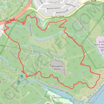
Name: Glenrock State Conservation Area Loop GPS track, route, trail.
Start: Gun Club Road, Merewether, Newcastle, Newcastle City Council, New South Wales, 2291, Australia (-32.95152 151.72233)
End: Gun Club Road, Merewether, Newcastle, Newcastle City Council, New South Wales, 2291, Australia (-32.95178 151.72243)
Coordinates: -32.96089 151.72231 -32.94928 151.74036

Other GPS tracks

Fernleigh Rail Trail

Australia > New South Wales > Belmont

#Bike

Distance: 21.1 Km - Elevation gain: 167 m - Maximum elevation: 98 m - Coordinates: -33.03927 151.66094 -32.92365 151.77083

Start: Gen Street, Belmont, Lake Macquarie City Council, New South Wales, 2280, Australia (-33.03877 151.66094)

End: Maritime Centre Newcastle, Honeysuckle Drive, Newcastle, Newcastle City Council, New South Wales, 2300, Australia (-32.92504 151.77083)

Teralba - Newcastle

Australia > New South Wales

#Hike

Distance: 25.4 Km - Elevation gain: 391 m - Maximum elevation: 111 m - Coordinates: -32.97539 151.60369 -32.92632 151.78488

Start: Teralba, StreetToTransitConnection, Teralba, Lake Macquarie City Council, New South Wales, 2284, Australia (-32.96241 151.60369)

End: Telstra, Watt Street, Newcastle, Newcastle City Council, New South Wales, 2300, Australia (-32.92632 151.78446)

Broadmeadow - Readhead Beach - Belmont

Australia > New South Wales

Fernleigh Track. #Bike

Distance: 36.8 Km - Elevation gain: 300 m - Maximum elevation: 97 m - Coordinates: -33.03927 151.65557 -32.92164 151.74146

Start: Fernleigh Track, Whitebridge, Lake Macquarie City Council, New South Wales, 2290, Australia (-32.97650 151.71248)

End: Broadmeadow, Graham Road, Nine ways, Broadmeadow, Newcastle, Newcastle City Council, New South Wales, 2292, Australia (-32.92328 151.73421)