Bondi Beach - Coogee Beach
Interactive map
GPS track profile
About this GPS track
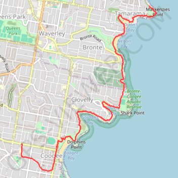
Name: Bondi Beach - Coogee Beach GPS track, route, trail
Coordinates: -33.92421 151.25005 -33.89763 151.27625
Topography: Sydney topographic map
Other GPS tracks
Click on a GPS track to view route, its statistics and profile.
Bondi Beach - Cooge Beach
Australia > New South Wales > Sydney
#Hike
Distance: 6.5 Km • Elevation gain: 181 m • Maximum elevation: 44 m