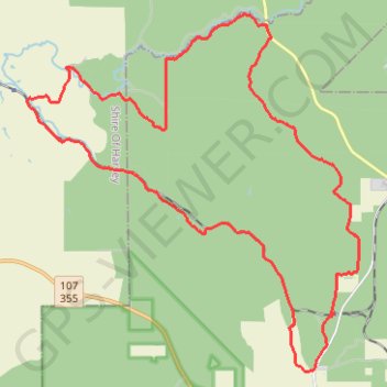
Big Tree road area MTB ride
Fantastic Mountain Bike Ride
- Distance: 40.4 Km
- Elevation gain: 645 m
- Maximum elevation: 281 m
- Elevation loss: 645 m
- Minimum elevation: 78 m
- Moving time: 3 h 11 m
- Moving speed: 12.7 Km/h
- Maximum speed: 48.0 Km/h
- Total time: 4 h 17 m
- Global speed: 9.4 Km/h
Interactive map
GPS track profile
About this GPS track
Name: Big Tree road area MTB ride GPS track, route, trail
Coordinates: -33.30794 115.91386 -33.21110 116.02153
Topography: Western Australia topographic map, elevation, terrain
Other GPS tracks
Click on a GPS track to view its route, statistics and profile.
Herman road loop - New section of Mundabiddi trail
Morning Mountain Bike Ride
Distance: 29.5 Km • Elevation gain: 387 m • Maximum elevation: 283 m
Martins Rock Lookout Loop in the Wellington National Park
Mountain Bike Ride in the Wilderness
Distance: 22.4 Km • Elevation gain: 362 m • Maximum elevation: 282 m
Perth to Sydney
Australie > Australie occidentale > City of Belmont
Distance: 3,801.3 Km • Elevation gain: 14,558 m • Maximum elevation: 1,159 m