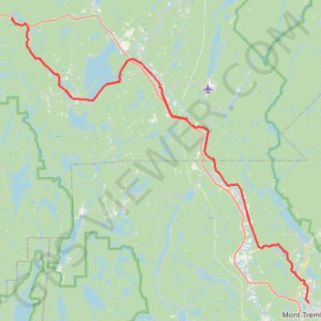
Mont-Tremblant - Lac Nominingue - Lac Saguay
#Vélo
- Distance: 158.6 Km
- Elevation gain: 807 m
- Maximum elevation: 330 m
- Elevation loss: 807 m
- Minimum elevation: 206 m
Interactive map
GPS track profile
About this GPS track
Name: Mont-Tremblant - Lac Nominingue - Lac Saguay GPS track, route, trail
Coordinates: 46.13052 -75.14623 46.49875 -74.59077
Other GPS tracks
Click on a GPS track to view route, its statistics and profile.