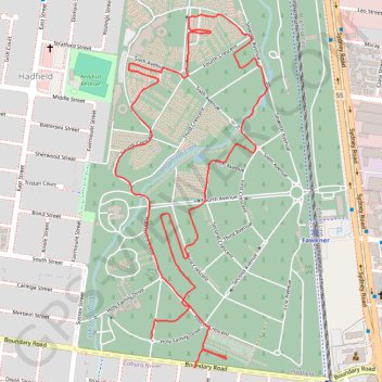
Paths and highways in Fawkner Memorial Park
- Distance: 4.1 Km
- Elevation gain: 21 m
- Maximum elevation: 78 m
- Elevation loss: 19 m
- Minimum elevation: 70 m
- Moving time: 23 m 34 s
- Moving speed: 10.5 Km/h
- Maximum speed: 20.8 Km/h
- Total time: 23 m 34 s
- Global speed: 10.5 Km/h
- Date: 04/04/24
Interactive map
GPS track profile
About this GPS track
Name: Paths and highways in Fawkner Memorial Park GPS track, route, trail
Coordinates: -37.71862 144.95321 -37.70839 144.95875
Topography: Melbourne topographic map