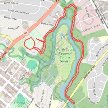
Coffs Creek Walk and Cycleway
Morning Run
- Distance: 6.7 Km
- Elevation gain: 36 m
- Maximum elevation: 12 m
- Elevation loss: 36 m
- Minimum elevation: 2 m
- Moving time: 35 m 11 s
- Moving speed: 11.4 Km/h
- Maximum speed: 26.2 Km/h
- Total time: 35 m 11 s
- Global speed: 11.4 Km/h
Interactive map
GPS track profile
About this GPS track
Name: Coffs Creek Walk and Cycleway GPS track, route, trail
Coordinates: -30.30095 153.11900 -30.28745 153.12829
Topography: Coffs Harbour topographic map, elevation, terrain
Other GPS tracks
Click on a GPS track to view its route, statistics and profile.
North Coast Regional Botanic Garden loop
Australia > New South Wales > Coffs Harbour
Lunch Run
Distance: 6.4 Km • Elevation gain: 33 m • Maximum elevation: 11 m