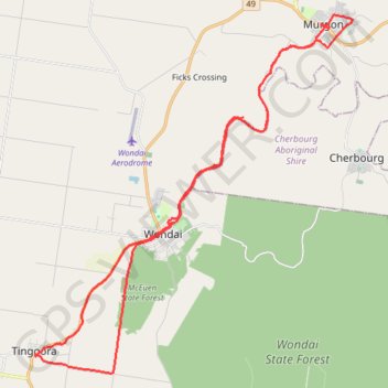
Tinny-Murgon
Rail trail and roads Tingoora to Murgon
- Distance: 50.8 Km
- Elevation gain: 412 m
- Maximum elevation: 414 m
- Elevation loss: 412 m
- Minimum elevation: 279 m
- Moving time: 2 h 40 m
- Moving speed: 19.0 Km/h
- Maximum speed: 52.7 Km/h
- Total time: 3 h 17 m
- Global speed: 15.4 Km/h
- Date: 01/04/24
Interactive map
GPS track profile
About this GPS track
Name: Tinny-Murgon GPS track, route, trail
Coordinates: -26.37068 151.82098 -26.23740 151.95277
Topography: Queensland topographic map
Other GPS tracks
Click on a GPS track to view route, its statistics and profile.
Murgon - Kingaroy
Australia > Queensland > Murgon
#Bike
Distance: 48.4 Km • Elevation gain: 335 m • Maximum elevation: 489 m