Coolum Beach - Wooroi Forest
Interactive map
GPS track profile
About this GPS track
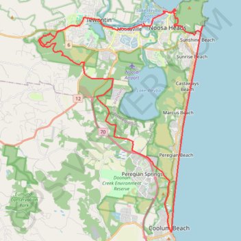
Name: Coolum Beach - Wooroi Forest GPS track, route, trail
Coordinates: -26.53188 152.99498 -26.38486 153.11569
Topography: Sunshine Coast Regional topographic map
Other GPS tracks
Click on a GPS track to view route, its statistics and profile.
Tinbeerwah - Tewantin National Park - Ringtail State Forest
Australia > Queensland > Tewantin
#MTB #Loop #Tinbeerwah #Tewantin #Ringtail
Distance: 48.7 Km • Elevation gain: 707 m • Maximum elevation: 219 m