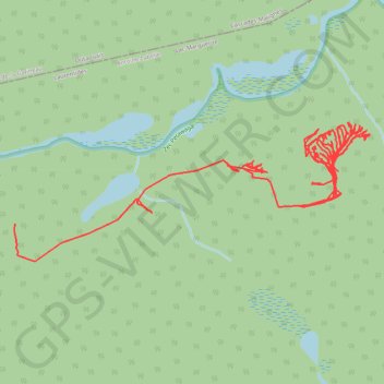
Tracklog
- Distance: 11.8 Km
- Elevation gain: 325 m
- Maximum elevation: 394 m
- Elevation loss: 392 m
- Minimum elevation: 321 m
Interactive map
GPS track profile
About this GPS track
Name: Tracklog GPS track, route, trail
Start: Lac-Marguerite, Antoine-Labelle, Laurentides, Québec, Canada (47.18682 -76.06513)
End: Lac-Marguerite, Antoine-Labelle, Laurentides, Québec, Canada (47.18486 -76.08679)
Coordinates: 47.18307 -76.08683 47.18974 -76.06165
Other GPS tracks
Click on a GPS track to view route, its statistics and profile.
Tracklog
Canada > Québec > Antoine-Labelle > Lac-Marguerite
Distance: 13.3 Km • Elevation gain: 269 m • Maximum elevation: 381 m
Tracklog
Canada > Québec > Antoine-Labelle > Lac-Marguerite
Distance: 13.1 Km • Elevation gain: 309 m • Maximum elevation: 393 m