Trace des Cretes
- Distance: 1.5 Km
- Elevation gain: 24 m
- Maximum elevation: 51 m
- Elevation loss: 68 m
- Minimum elevation: 0 m
Interactive map
GPS track profile
About this GPS track
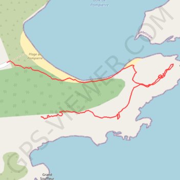
Name: Trace des Cretes GPS track, route, trail
Coordinates: 15.87020 -61.57231 15.87203 -61.56691
Other GPS tracks
Click on a GPS track to view route, its statistics and profile.
Morel
France > Guadeloupe > Terre-de-Haut > Le Marigot
Distance: 4.4 Km • Elevation gain: 345 m • Maximum elevation: 120 m