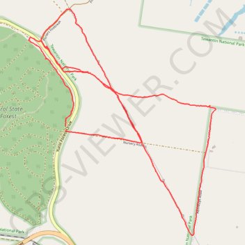
Yurol State Forest - Yurol Road Crossing
Morning Run
- Distance: 10.8 Km
- Elevation gain: 146 m
- Maximum elevation: 130 m
- Elevation loss: 144 m
- Minimum elevation: 94 m
- Moving time: 1 h 19 m
- Moving speed: 8.1 Km/h
- Maximum speed: 15.5 Km/h
- Total time: 1 h 25 m
- Global speed: 7.5 Km/h
- Date: 17/03/24
Interactive map
GPS track profile
About this GPS track
Name: Yurol State Forest - Yurol Road Crossing GPS track, route, trail
Start: Yurol Forest Drive, Pomona, Noosa Shire, Queensland, 4568, Australia (-26.38171 152.88797)
End: Yurol Forest Drive, Pomona, Noosa Shire, Queensland, 4568, Australia (-26.38209 152.88805)
Coordinates: -26.39212 152.88411 -26.37061 152.90392
Topography: Queensland topographic map
Other GPS tracks
Click on a GPS track to view route, its statistics and profile.