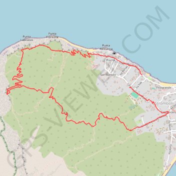
Stromboli selbst
- Distance: 8.0 Km
- Elevation gain: 474 m
- Maximum elevation: 310 m
- Elevation loss: 491 m
- Minimum elevation: 6 m
- Moving time: 2 h 26 m
- Moving speed: 3.3 Km/h
- Maximum speed: 14.6 Km/h
- Total time: 5 h 33 m
- Global speed: 1.4 Km/h
- Date: 11/10/21
Interactive map
GPS track profile
About this GPS track
Name: Stromboli selbst GPS track, route, trail
Coordinates: 38.80082 15.21381 38.81084 15.23822
Topography: Messina topographic map
Other GPS tracks
Click on a GPS track to view route, its statistics and profile.