Venman and Daisy parks
- Distance: 19.1 Km
- Elevation gain: 376 m
- Maximum elevation: 139 m
- Elevation loss: 358 m
- Minimum elevation: 28 m
- Moving time: 2 h 19 m
- Moving speed: 8.2 Km/h
- Maximum speed: 15.4 Km/h
- Total time: 2 h 21 m
- Global speed: 8.1 Km/h
Interactive map
GPS track profile
About this GPS track
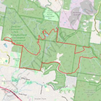
Name: Venman and Daisy parks GPS track, route, trail
Coordinates: -27.64000 153.15229 -27.61684 153.20484
Topography: Queensland topographic map, elevation, terrain
Other GPS tracks
Click on a GPS track to view its route, statistics and profile.
Daisy Hill Loop
Distance: 16.8 Km • Elevation gain: 290 m • Maximum elevation: 119 m