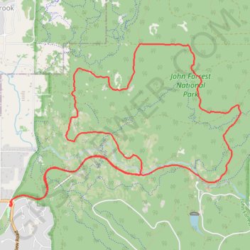
Railway Reserves Heritage North Trail and Eagle View Track
- Distance: 16.3 Km
- Elevation gain: 359 m
- Maximum elevation: 237 m
- Elevation loss: 359 m
- Minimum elevation: 66 m
- Moving time: 1 h 38 m
- Moving speed: 9.9 Km/h
- Maximum speed: 12.0 Km/h
- Total time: 1 h 38 m
- Global speed: 9.9 Km/h
- Date: 01/01/10
Interactive map
GPS track profile
About this GPS track
Name: Railway Reserves Heritage North Trail and Eagle View Track GPS track, route, trail
Coordinates: -31.88679 116.06037 -31.86323 116.09978
Topography: Western Australia topographic map
Other GPS tracks
Click on a GPS track to view route, its statistics and profile.
Swan View Tunnel and Falls
John Forrest National Park. #Hike #Loop #JohnForrest
Distance: 5.8 Km • Elevation gain: 102 m • Maximum elevation: 148 m
Perth to Sydney
Australie > Australie occidentale > City of Belmont
Distance: 3,801.3 Km • Elevation gain: 14,558 m • Maximum elevation: 1,159 m
2021 Toodyay return via Kep
Distance: 229.9 Km • Elevation gain: 1,859 m • Maximum elevation: 357 m
Red Hill - Eagle View Track
Australie > Australie occidentale
John Forrest National Park. #Hike #Loop #RedHill #JohnForrest
Distance: 24.2 Km • Elevation gain: 465 m • Maximum elevation: 269 m
Kep 75k
Distance: 76.6 Km • Elevation gain: 899 m • Maximum elevation: 310 m
Kep 100k
Distance: 104.1 Km • Elevation gain: 1,034 m • Maximum elevation: 322 m
Railway Reserves Heritage Trail
Distance: 42.9 Km • Elevation gain: 390 m • Maximum elevation: 323 m