Himmeltindan 002
- Distance: 8.1 Km
- Elevation gain: 960 m
- Maximum elevation: 922 m
- Elevation loss: 962 m
- Minimum elevation: 3 m
Interactive map
GPS track profile
About this GPS track
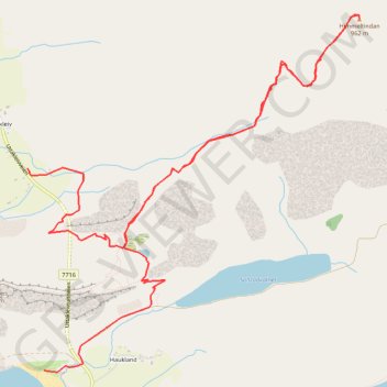
Name: Himmeltindan 002 GPS track, route, trail
Start: Uttakleivveien, Uttakleiv, Vestvågøy, Nordland, Norvège (68.20992 13.52487)
End: Uttakleivveien, Sjøbakken, Vestvågøy, Nordland, Norvège (68.19929 13.52723)
Coordinates: 68.19917 13.52487 68.21801 13.57188
Other GPS tracks
Click on a GPS track to view route, its statistics and profile.
Stage 1: Arctic Ocean to Väylä — European Divide Trail
Distance: 2,785.0 Km • Elevation gain: 23,823 m • Maximum elevation: 722 m