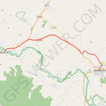
Alexandra - Cathkin - Molesworth
#Bike
- Distance: 19.7 Km
- Elevation gain: 197 m
- Maximum elevation: 288 m
- Elevation loss: 238 m
- Minimum elevation: 169 m
Interactive map
GPS track profile
About this GPS track
Name: Alexandra - Cathkin - Molesworth GPS track, route, trail
Start: Grant Street, Alexandra, Shire of Murrindindi, Victoria, 3714, Australia (-37.19340 145.71034)
Coordinates: -37.19340 145.54191 -37.14281 145.71437
Topography: Victoria topographic map
Other GPS tracks
Click on a GPS track to view route, its statistics and profile.
Tallarook - Eildon - Hurstbridge
Australia > Victoria > Tallarook
#Bike
Distance: 278.8 Km • Elevation gain: 4,897 m • Maximum elevation: 868 m
Molesworth - Yea
Australia > Victoria > Molesworth
Great Victorian Rail Trail. #Bike
Distance: 17.8 Km • Elevation gain: 189 m • Maximum elevation: 303 m