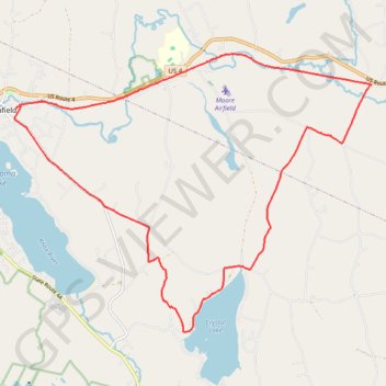
Crystal Lake Trail
- Distance: 22.4 Km
- Elevation gain: 357 m
- Maximum elevation: 345 m
- Elevation loss: 355 m
- Minimum elevation: 236 m
- Moving time: 1 h 7 m
- Moving speed: 19.9 Km/h
- Maximum speed: 50.7 Km/h
- Total time: 1 h 10 m
- Global speed: 19.1 Km/h
- Date: 04/05/24
Interactive map
GPS track profile
About this GPS track
Name: Crystal Lake Trail GPS track, route, trail
Start: Union Street, Enfield, Grafton County, New Hampshire, 03748, United States (43.64132 -72.14016)
End: Union Street, Enfield, Grafton County, New Hampshire, 03748, United States (43.64094 -72.14091)
Coordinates: 43.59924 -72.14139 43.65113 -72.04947
Other GPS tracks
Click on a GPS track to view route, its statistics and profile.