Ultra-Trail d'Angkor
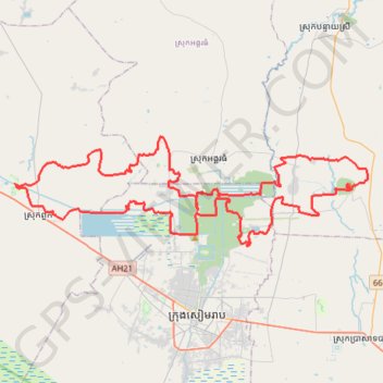
Interactive map
GPS track profile
About this GPS track
Name: Ultra-Trail d'Angkor GPS track, route, trail
Start: Angkor Thom, សៀគ្វីតូច, Siem Reap, ក្រុងសៀមរាប, Siem Reap, Cambodge (13.44583 103.85990)
End: Angkor Thom, សៀគ្វីតូច, Siem Reap, ក្រុងសៀមរាប, Siem Reap, Cambodge (13.44583 103.85989)
Coordinates: 13.41712 103.70869 13.50455 104.00070