Mount Carrigain
Hike from Sawyer River to Mount Carrigain via Signal Ridge Trail in the White Mountain National Forest. #Hike #Mountain #Forest #Nature #River
- Distance: 16.4 Km
- Elevation gain: 1,007 m
- Maximum elevation: 1,407 m
- Elevation loss: 1,005 m
- Minimum elevation: 425 m
- Moving time: 4 h 32 m
- Moving speed: 3.6 Km/h
- Maximum speed: 6.4 Km/h
- Total time: 5 h 23 m
- Global speed: 3.0 Km/h
- Date: 22/08/23
Interactive map
GPS track profile
About this GPS track
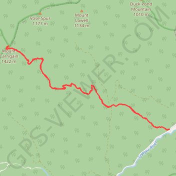
Name: Mount Carrigain GPS track, route, trail
Coordinates: 44.06991 -71.44755 44.09368 -71.38352
Other GPS tracks
Click on a GPS track to view route, its statistics and profile.