Baw Baw National Park
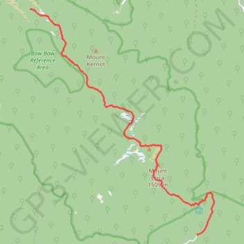
Interactive map
GPS track profile
About this GPS track
Name: Baw Baw National Park GPS track, route, trail
Start: Australian Alps Walking Track, Baw Baw, Shire of Baw Baw, Victoria, Australia (-37.89220 146.35540)
End: Baw Baw National Park, Baw Baw, Shire of Baw Baw, Victoria, Australia (-37.84017 146.30646)
Coordinates: -37.89245 146.30646 -37.84017 146.36039
Topography: Victoria topographic map
Other GPS tracks
Click on a GPS track to view route, its statistics and profile.
Traralgon - Walhalla - Woods Point
Australia > Victoria > Traralgon
#Bike
Distance: 124.6 Km • Elevation gain: 4,258 m • Maximum elevation: 1,165 m
Moe - Woods Point
#Bike
Distance: 109.2 Km • Elevation gain: 3,295 m • Maximum elevation: 1,165 m