2017-09-28_13-27-33
En aller simple.
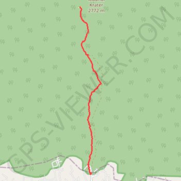
- Distance: 8.1 Km
- Elevation gain: 5 m
- Maximum elevation: 2,709 m
- Elevation loss: 842 m
- Minimum elevation: 1,866 m
- Moving time: 1 h 44 m
- Moving speed: 4.6 Km/h
- Maximum speed: 16.9 Km/h
- Total time: 1 h 52 m
- Global speed: 4.3 Km/h
- Date: 28/09/17
Interactive map
GPS track profile
About this GPS track
Name: 2017-09-28_13-27-33 GPS track, route, trail
Start: Mandara Huts, Rombo, Kilimandjaro, Northern Zone, Tanzanie (-3.18182 37.51338)
Coordinates: -3.24263 37.51332 -3.18158 37.52102
Other GPS tracks
Click on a GPS track to view route, its statistics and profile.
2017-09-28_10-33-13
En aller simple.
Distance: 8.1 Km • Elevation gain: 8 m • Maximum elevation: 3,442 m